Search results
Jump to navigation
Jump to search
Page title matches
- 2 KB (246 words) - 17:32, 12 June 2011
- * '''parameter''': sender bcc maps1 KB (202 words) - 14:36, 8 October 2010
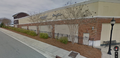
File:2016-07-17 screencap Google Maps - Healing Waters Durham.png ...3.56t/data=!3m6!1e1!3m4!1sQyNr-z_m6azuP8WXNa8a8A!2e0!7i13312!8i6656 Google Maps Streetview] on 2016-07-17(1,064 × 514 (745 KB)) - 00:38, 18 July 2016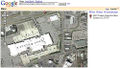
File:20941955 7ff7ebbf46 z.Google Maps satellite view of South Square Mall.jpg * '''what''': [[Google Maps]] satellite view of [[South Square Mall]](500 × 284 (64 KB)) - 19:54, 16 July 2017


Page text matches
- ...s://www.google.com/maps/@61.2294862,-48.0958832,1658m/data=!3m1!1e3 Google Maps] ...s://www.google.com/maps/@70.4993277,-51.2886639,2300m/data=!3m1!1e3 Google Maps]3 KB (454 words) - 20:02, 18 June 2022
- ==Maps==259 bytes (40 words) - 11:35, 12 September 2010
- ...tbox will also provide links to [[MediaWiki:Smw service online maps|online maps]]; this uses SMW's [[smw:Help:Service_links|service links]] feature. {{#set:Has type=Geographic coordinate|Provides service=online maps}}385 bytes (56 words) - 23:12, 7 December 2010
- ==Maps==2 KB (270 words) - 00:34, 13 September 2008
File:2016-07-17 screencap Google Maps - Healing Waters Durham.png ...3.56t/data=!3m6!1e1!3m4!1sQyNr-z_m6azuP8WXNa8a8A!2e0!7i13312!8i6656 Google Maps Streetview] on 2016-07-17(1,064 × 514 (745 KB)) - 00:38, 18 July 2016
File:2010-04-15 Everwood satellite view.crop.jpg ...5.943669,-78.972108&spn=0.003118,0.00398&t=h&z=18 retrieved] from [[Google Maps]] on 2010-04-15(740 × 717 (166 KB)) - 14:22, 15 April 2010- * [[Postfix/main.cf/virtual mailbox maps|virtual mailbox maps]]678 bytes (93 words) - 19:20, 12 June 2011
- ...m=1000&ll=34.134035,-118.321799&spn=0.002815,0.005021&t=h&z=18&om=1 Google Maps] hybrid view390 bytes (48 words) - 17:11, 29 October 2007
File:Shawcr3.gif [[category:maps]](669 × 408 (111 KB)) - 14:15, 3 April 2011File:20941955 7ff7ebbf46 z.Google Maps satellite view of South Square Mall.jpg * '''what''': [[Google Maps]] satellite view of [[South Square Mall]](500 × 284 (64 KB)) - 19:54, 16 July 2017- ==Maps==2 KB (243 words) - 19:01, 20 September 2010
- ...esult?addr=1309+Halley+Street&csz=durham%2C+nc&country=us 1309] or [http://maps.yahoo.com/maps_result?addr=1313+Halley+Street&csz=durham%2C+nc&country=us 1 * Both Google Maps and Yahoo Maps show Halley Street as connecting with Carroll Street to the west; it actual2 KB (333 words) - 17:59, 1 October 2011
- ...1945+E+Cornwallis+Rd&csz=27713&country=us yahoo]| |[http://maps.google.com/maps?f=q&hl=en&q=1945+E+Cornwallis+Rd.+27713&ie=UTF8&om=1 google]|496 bytes (66 words) - 20:41, 18 December 2018
- ...p://maps.yahoo.com/maps_result?csz=washington%2C+nc&country=us&new=1 Yahoo Maps]700 bytes (83 words) - 19:55, 13 October 2006
- [[File:2016-07-17 screencap Google Maps - Healing Waters Durham.png|The logo looks the same as the one on [[Healing362 bytes (59 words) - 18:01, 3 September 2016
- ==Maps==2 KB (320 words) - 12:17, 14 August 2022
- ...7ff7ebbf46 z.Google Maps satellite view of South Square Mall.jpg | Google Maps satellite view2 KB (295 words) - 17:46, 25 October 2022
- ==Maps== There is a small gap between the two sections of trail shown in these maps. The second map shows mostly the [[../south of I-40|south of I-40]] section3 KB (481 words) - 00:00, 16 July 2010
- ** '''clsCatPages''' (extends clsVbzTable): maps URL fragments to catalog pages648 bytes (78 words) - 17:53, 8 January 2016
- .../maps.yahoo.com/maps_result?csz=topsail+beach%2C+nc&country=us&new=1 Yahoo Maps]648 bytes (79 words) - 16:28, 23 June 2015

