Search results
Jump to navigation
Jump to search
Page title matches
- the road on which a particular thing is located109 bytes (15 words) - 15:43, 17 July 2011
- * [[US/NC/Durham/neighborhoods/Pinecrest Road|neighborhood]]197 bytes (23 words) - 18:14, 14 March 2012
- #REDIRECT [[US/NC/Durham/neighborhoods/Pinecrest Road/scrapbook]]65 bytes (8 words) - 23:18, 23 June 2010
- #REDIRECT [[US/NC/Durham/neighborhoods/Pinecrest Road]]55 bytes (7 words) - 21:25, 23 June 2010
- #REDIRECT [[US/NC/Durham/neighborhoods/Pinecrest Road/speed humps]]67 bytes (9 words) - 22:46, 23 June 2010
- 50 bytes (6 words) - 18:26, 19 June 2008
File:P2250003 wheels signs and road.jpg (640 × 480 (80 KB)) - 13:36, 26 February 2006- #REDIRECT [[US/NC/Durham/neighborhoods/Pinecrest Road/crime]]61 bytes (8 words) - 22:42, 23 June 2010
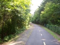
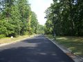
File:2008-08-19 ATT 100 4226 Riddle Road extension.web.jpg ...gory:2008-08-19]]The [[American Tobacco Trail/Riddle Road extension|Riddle Road extension]] of the [[American Tobacco Trail]], heading northeast ...ension.web.jpg|previous ←]] | [[:Image:2008-08-19 ATT 100 4227 Riddle Road crossing.web.jpg|→ next]](1,024 × 768 (329 KB)) - 01:50, 14 November 2008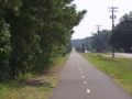
File:2008-08-19 ATT 100 4235 Riddle Road extension.web.jpg ...gory:2008-08-19]]The [[American Tobacco Trail/Riddle Road extension|Riddle Road extension]] of the [[American Tobacco Trail]], heading east - east of [[NC [[:Image:2008-08-19 ATT 100 4234 Riddle Road extension.web.jpg|previous ←]] |(1,024 × 768 (203 KB)) - 01:55, 14 November 2008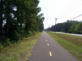
File:2008-08-19 ATT 100 4234 Riddle Road extension.web.jpg ...gory:2008-08-19]]The [[American Tobacco Trail/Riddle Road extension|Riddle Road extension]] of the [[American Tobacco Trail]], heading east - just east of ...ension.web.jpg|previous ←]] | [[:Image:2008-08-19 ATT 100 4235 Riddle Road extension.web.jpg|→ next]](1,024 × 768 (237 KB)) - 01:54, 14 November 2008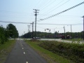
File:2008-08-19 ATT 100 4233 Riddle Road extension.web.jpg ...gory:2008-08-19]]The [[American Tobacco Trail/Riddle Road extension|Riddle Road extension]] of the [[American Tobacco Trail]], heading northeast - coming u ...ension.web.jpg|previous ←]] | [[:Image:2008-08-19 ATT 100 4234 Riddle Road extension.web.jpg|→ next]](1,024 × 768 (183 KB)) - 01:53, 14 November 2008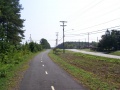
File:2008-08-19 ATT 100 4232 Riddle Road extension.web.jpg ...of the [[American Tobacco Trail]], heading northeast - between the Riddle Road crossing and [[NC 55]] ...ension.web.jpg|previous ←]] | [[:Image:2008-08-19 ATT 100 4233 Riddle Road extension.web.jpg|→ next]](1,024 × 768 (242 KB)) - 01:52, 14 November 2008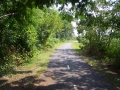
File:2008-08-19 ATT 100 4231 Riddle Road extension.web.jpg ...of the [[American Tobacco Trail]], heading northeast - between the Riddle Road crossing and [[NC 55]] ...ension.web.jpg|previous ←]] | [[:Image:2008-08-19 ATT 100 4232 Riddle Road extension.web.jpg|→ next]](1,024 × 768 (407 KB)) - 01:52, 14 November 2008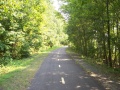
File:2008-08-19 ATT 100 4230 Riddle Road extension.web.jpg ...of the [[American Tobacco Trail]], heading northeast - between the Riddle Road crossing and [[NC 55]] ...ossing.web.jpg|previous ←]] | [[:Image:2008-08-19 ATT 100 4231 Riddle Road extension.web.jpg|→ next]](1,024 × 768 (387 KB)) - 01:52, 14 November 2008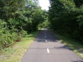
File:2008-08-19 ATT 100 4229 Riddle Road extension.web.jpg ...American Tobacco Trail]], heading northeast - just northeast of the Riddle Road crossing ...ossing.web.jpg|previous ←]] | [[:Image:2008-08-19 ATT 100 4230 Riddle Road extension.web.jpg|→ next]](1,024 × 768 (320 KB)) - 01:51, 14 November 2008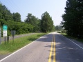
File:2008-08-19 ATT 100 4228 Riddle Road crossing.web.jpg ...heast from where the [[American Tobacco Trail/Riddle Road extension|Riddle Road extension]] of the [[American Tobacco Trail]] crosses it ...ossing.web.jpg|previous ←]] | [[:Image:2008-08-19 ATT 100 4229 Riddle Road extension.web.jpg|→ next]](1,024 × 768 (221 KB)) - 01:51, 14 November 2008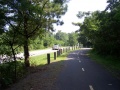
File:2008-08-19 ATT 100 4227 Riddle Road crossing.web.jpg ...f the [[American Tobacco Trail]], heading northeast - almost to the Riddle Road crossing ...ension.web.jpg|previous ←]] | [[:Image:2008-08-19 ATT 100 4228 Riddle Road crossing.web.jpg|→ next]](1,024 × 768 (299 KB)) - 01:51, 14 November 2008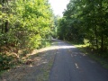
File:2008-08-19 ATT 100 4225 Riddle Road extension.web.jpg ...gory:2008-08-19]]The [[American Tobacco Trail/Riddle Road extension|Riddle Road extension]] of the [[American Tobacco Trail]], heading northeast ...ension.web.jpg|previous ←]] | [[:Image:2008-08-19 ATT 100 4226 Riddle Road extension.web.jpg|→ next]](1,024 × 768 (376 KB)) - 01:50, 14 November 2008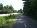
File:2008-08-19 ATT 100 4224 Riddle Road extension.web.jpg ...gory:2008-08-19]]The [[American Tobacco Trail/Riddle Road extension|Riddle Road extension]] of the [[American Tobacco Trail]], heading northeast ...ferret.web.jpg|previous ←]] | [[:Image:2008-08-19 ATT 100 4225 Riddle Road extension.web.jpg|→ next]](1,024 × 768 (230 KB)) - 01:50, 14 November 2008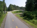
File:2008-08-19 ATT 100 4222 Riddle Road extension.jpg ...oad]], facing north; [[American Tobacco Trail/Riddle Road extension|Riddle Road extension]] visible ahead on right(1,024 × 768 (258 KB)) - 01:48, 14 November 2008- #REDIRECT [[US/NC/Durham/neighborhoods/Pinecrest Road/block party]]67 bytes (9 words) - 23:23, 23 June 2010
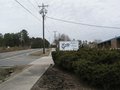
- ...residents of the "old" section of [[US/NC/Durham/roads/Pinecrest|Pinecrest Road]] in [[Durham, NC]]. There is a Yahoo Groups mailing list where these resid To the best of [[User:Woozle|my]] knowledge, residents of the "new" Pinecrest Road have never expressed an interest in being involved with the "old" section,948 bytes (138 words) - 00:06, 24 June 2010
- ...line petition about this? Some pictures showing the available space in the road (hover over thumbnails to see caption; click on thumbnail for larger pictur ...rs, parked opposite each other on the Academy-Dogwood section of Pinecrest Road]]4 KB (701 words) - 23:16, 23 June 2010
- ...d and a gym bag was taken and left several houses away by the side of the road. Car was in the driveway behind our house. Locked van was not broken int ...swerve to miss the bicylcle the thief had left lying in the middle of the road. They caught him in the back seat of my car picking up my laptop. He said h6 KB (1,077 words) - 13:55, 27 May 2018
- ''Pam Winton, who is still the official Pinecrest Road historian because no one else wants to do it, went through the scrapbook an Since the first Pinecrest Road party in 1981, residents have been invited to gather in the street center a5 KB (704 words) - 23:18, 23 June 2010
- ...ing (or preventing) speed humps on [[Pinecrest Road Neighborhood|Pinecrest Road]]. ...ds were sufficiently above the posted speed of 25 MPH to qualify Pinecrest Road for speed humps, so the "qualify" step has now been done.19 KB (3,226 words) - 22:46, 23 June 2010
- Every year, the [[US/NC/Durham/neighborhoods|Pinecrest Road Neighborhood]] holds a block party. Some highlights from past parties are i ...he block (where "the block" is the section from Highway 751 to Chapel Hill Road)679 bytes (92 words) - 23:57, 23 September 2010


Page text matches
File:2008-08-19 ATT 100 4228 Riddle Road crossing.web.jpg ...heast from where the [[American Tobacco Trail/Riddle Road extension|Riddle Road extension]] of the [[American Tobacco Trail]] crosses it ...ossing.web.jpg|previous ←]] | [[:Image:2008-08-19 ATT 100 4229 Riddle Road extension.web.jpg|→ next]](1,024 × 768 (221 KB)) - 01:51, 14 November 2008
File:2008-08-19 ATT 100 4223 tilted ferret.web.jpg ...and turning onto the [[American Tobacco Trail/Riddle Road extension|Riddle Road extension]] ...extension.jpg|previous ←]] | [[:Image:2008-08-19 ATT 100 4224 Riddle Road extension.web.jpg|→ next]](1,024 × 768 (271 KB)) - 01:49, 14 November 2008File:2008-08-19 ATT 100 4231 Riddle Road extension.web.jpg ...of the [[American Tobacco Trail]], heading northeast - between the Riddle Road crossing and [[NC 55]] ...ension.web.jpg|previous ←]] | [[:Image:2008-08-19 ATT 100 4232 Riddle Road extension.web.jpg|→ next]](1,024 × 768 (407 KB)) - 01:52, 14 November 2008File:2008-08-19 ATT 100 4232 Riddle Road extension.web.jpg ...of the [[American Tobacco Trail]], heading northeast - between the Riddle Road crossing and [[NC 55]] ...ension.web.jpg|previous ←]] | [[:Image:2008-08-19 ATT 100 4233 Riddle Road extension.web.jpg|→ next]](1,024 × 768 (242 KB)) - 01:52, 14 November 2008File:2008-08-19 ATT 100 4227 Riddle Road crossing.web.jpg ...f the [[American Tobacco Trail]], heading northeast - almost to the Riddle Road crossing ...ension.web.jpg|previous ←]] | [[:Image:2008-08-19 ATT 100 4228 Riddle Road crossing.web.jpg|→ next]](1,024 × 768 (299 KB)) - 01:51, 14 November 2008File:2008-08-19 ATT 100 4230 Riddle Road extension.web.jpg ...of the [[American Tobacco Trail]], heading northeast - between the Riddle Road crossing and [[NC 55]] ...ossing.web.jpg|previous ←]] | [[:Image:2008-08-19 ATT 100 4231 Riddle Road extension.web.jpg|→ next]](1,024 × 768 (387 KB)) - 01:52, 14 November 2008- [[thing type::road]] [[name::McDowell Road]]500 bytes (69 words) - 02:06, 8 September 2011
File:2008-08-19 ATT 100 4229 Riddle Road extension.web.jpg ...American Tobacco Trail]], heading northeast - just northeast of the Riddle Road crossing ...ossing.web.jpg|previous ←]] | [[:Image:2008-08-19 ATT 100 4230 Riddle Road extension.web.jpg|→ next]](1,024 × 768 (320 KB)) - 01:51, 14 November 2008File:2008-08-19 ATT 100 4222 Riddle Road extension.jpg ...oad]], facing north; [[American Tobacco Trail/Riddle Road extension|Riddle Road extension]] visible ahead on right(1,024 × 768 (258 KB)) - 01:48, 14 November 2008File:2008-08-19 ATT 100 4226 Riddle Road extension.web.jpg ...gory:2008-08-19]]The [[American Tobacco Trail/Riddle Road extension|Riddle Road extension]] of the [[American Tobacco Trail]], heading northeast ...ension.web.jpg|previous ←]] | [[:Image:2008-08-19 ATT 100 4227 Riddle Road crossing.web.jpg|→ next]](1,024 × 768 (329 KB)) - 01:50, 14 November 2008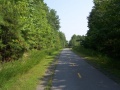
File:2008-08-19 ATT 100 4221.web.jpg ...-19]][[American Tobacco Trail]] south of [[US/NC/Durham/Riddle Road|Riddle Road]], facing north ...0 4220.web.jpg|previous ←]] | [[:Image:2008-08-19 ATT 100 4222 Riddle Road extension.jpg|→ next]](1,024 × 768 (269 KB)) - 01:48, 14 November 2008File:2008-08-19 ATT 100 4233 Riddle Road extension.web.jpg ...gory:2008-08-19]]The [[American Tobacco Trail/Riddle Road extension|Riddle Road extension]] of the [[American Tobacco Trail]], heading northeast - coming u ...ension.web.jpg|previous ←]] | [[:Image:2008-08-19 ATT 100 4234 Riddle Road extension.web.jpg|→ next]](1,024 × 768 (183 KB)) - 01:53, 14 November 2008File:2008-08-19 ATT 100 4225 Riddle Road extension.web.jpg ...gory:2008-08-19]]The [[American Tobacco Trail/Riddle Road extension|Riddle Road extension]] of the [[American Tobacco Trail]], heading northeast ...ension.web.jpg|previous ←]] | [[:Image:2008-08-19 ATT 100 4226 Riddle Road extension.web.jpg|→ next]](1,024 × 768 (376 KB)) - 01:50, 14 November 2008File:2008-08-19 ATT 100 4234 Riddle Road extension.web.jpg ...gory:2008-08-19]]The [[American Tobacco Trail/Riddle Road extension|Riddle Road extension]] of the [[American Tobacco Trail]], heading east - just east of ...ension.web.jpg|previous ←]] | [[:Image:2008-08-19 ATT 100 4235 Riddle Road extension.web.jpg|→ next]](1,024 × 768 (237 KB)) - 01:54, 14 November 2008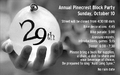
File:2010 29th blockparty.png ...h annual [[US/NC/Durham/neighborhoods/Pinecrest Road/block party|Pinecrest Road Block Party]](800 × 500 (194 KB)) - 23:55, 23 September 2010File:2008-08-19 ATT 100 4224 Riddle Road extension.web.jpg ...gory:2008-08-19]]The [[American Tobacco Trail/Riddle Road extension|Riddle Road extension]] of the [[American Tobacco Trail]], heading northeast ...ferret.web.jpg|previous ←]] | [[:Image:2008-08-19 ATT 100 4225 Riddle Road extension.web.jpg|→ next]](1,024 × 768 (230 KB)) - 01:50, 14 November 2008File:2008-08-19 ATT 100 4235 Riddle Road extension.web.jpg ...gory:2008-08-19]]The [[American Tobacco Trail/Riddle Road extension|Riddle Road extension]] of the [[American Tobacco Trail]], heading east - east of [[NC [[:Image:2008-08-19 ATT 100 4234 Riddle Road extension.web.jpg|previous ←]] |(1,024 × 768 (203 KB)) - 01:55, 14 November 2008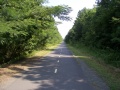
File:2008-08-19 ATT 100 4219.web.jpg ...-19]][[American Tobacco Trail]] south of [[US/NC/Durham/Riddle Road|Riddle Road]], facing north(1,024 × 768 (293 KB)) - 01:44, 14 November 2008- ===North Mineral Springs Road=== * '''Address''': 410 North Mineral Springs Road, Durham, NC {{zipcode|27703}}-3618531 bytes (63 words) - 00:15, 10 December 2010
- [[thing type::road]] [[name::Pinecrest Road]]1 KB (153 words) - 22:38, 6 October 2011
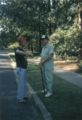
File:Pinecrest 02.web.jpg ...est Road Neighborhood]] residents, presumably at an [[Annual Old Pinecrest Road Block Party|annual block party]], circa 1986(545 × 800 (96 KB)) - 02:35, 17 January 2006- ...ner of [[Shannon Road (Durham, NC)|Shannon Road]] and [[Chapel Hill-Durham Road]]. It currently is anchored by a [[United States Postal Service|USPS]] bran681 bytes (96 words) - 15:37, 19 November 2007
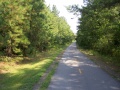
File:2008-08-19 ATT 100 4220.web.jpg ...-19]][[American Tobacco Trail]] south of [[US/NC/Durham/Riddle Road|Riddle Road]], facing north(1,024 × 768 (330 KB)) - 01:46, 14 November 2008- [[thing type::road]] ...pcode|27707}}. It is just off [[../Shannon|Shannon Road]] near the Shannon Road Post Office and not far from the [[South Square (Durham, NC)|South Square]]674 bytes (99 words) - 21:55, 29 August 2011
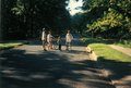
File:Pinecrest 03.web.jpg ...est Road Neighborhood]] residents, presumably at an [[Annual Old Pinecrest Road Block Party|annual block party]], circa 1986(640 × 434 (77 KB)) - 02:35, 17 January 2006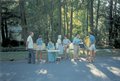
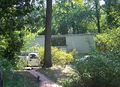
File:Pinecrest 01.web.jpg ...est Road Neighborhood]] residents, presumably at an [[Annual Old Pinecrest Road Block Party|annual block party]], circa 1986(1,531 × 1,034 (201 KB)) - 11:03, 8 July 2009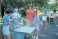
File:Pinecrest 04.web.jpg ...est Road Neighborhood]] residents, presumably at an [[Annual Old Pinecrest Road Block Party|annual block party]], circa 1986(640 × 433 (116 KB)) - 21:37, 30 July 2007- [[thing type::road]] [[name::Fayetteville Road]]1 KB (232 words) - 02:11, 8 September 2011
- #redirect [[Property:road]]27 bytes (3 words) - 18:53, 29 August 2011
- [[thing type::road]] ...easternmost block of [[connects to::US/NC/Durham/roads/Pinecrest|Pinecrest Road]].874 bytes (131 words) - 19:20, 29 August 2011
- ...found [Dr. Schlotterer] to be excellent." – customer in [[Pinecrest Road Neighborhood]] * Milo Hoffman (Hillandale Road?)973 bytes (131 words) - 11:42, 30 June 2011
- #redirect [[US/NC/Durham/neighborhoods/Pinecrest Road/speed humps]]67 bytes (9 words) - 23:15, 23 June 2010
- It is located at [[3519 Fayetteville Road (Durham, NC)|3519 Fayetteville Road]] near [[Hillside High School]].503 bytes (62 words) - 19:48, 19 June 2008
- ...residents of the "old" section of [[US/NC/Durham/roads/Pinecrest|Pinecrest Road]] in [[Durham, NC]]. There is a Yahoo Groups mailing list where these resid To the best of [[User:Woozle|my]] knowledge, residents of the "new" Pinecrest Road have never expressed an interest in being involved with the "old" section,948 bytes (138 words) - 00:06, 24 June 2010
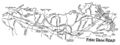
File:smallmap6.jpg * '''what''': map of [[Fish Dam Road]](1,443 × 536 (148 KB)) - 18:17, 1 June 2014- ...e has been removed (at Livia's request) and moved to [[htwiki:Danielsville Road|the HypertWiki]].128 bytes (19 words) - 01:53, 27 April 2006
- ...cated at the corner of [[US/NC/Durham/roads/Hillsborough Road|Hillsborough Road]] and Trent Drive.{{seedling}}1 KB (187 words) - 11:34, 3 June 2009
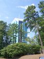
File:100 6072.JPG ...sity Tower]] -- a view from closer to [[US/NC/Durham/roads/Pickett|Pickett Road]](1,932 × 2,576 (1.59 MB)) - 20:54, 29 August 2011- * [http://erwinneighbor.org/ Erwin (Road) Area Neighborhood Group] * [[/Pinecrest Road|Pinecrest Road]]2 KB (210 words) - 21:31, 23 June 2010
- Every year, the [[US/NC/Durham/neighborhoods|Pinecrest Road Neighborhood]] holds a block party. Some highlights from past parties are i ...he block (where "the block" is the section from Highway 751 to Chapel Hill Road)679 bytes (92 words) - 23:57, 23 September 2010
- the road on which a particular thing is located109 bytes (15 words) - 15:43, 17 July 2011
- * [[US/NC/Durham/neighborhoods/Pinecrest Road|Pinecrest Road Neighborhood]]650 bytes (95 words) - 14:26, 3 April 2011
- {{#ask:[[page type::address]][[road::{{FULLPAGENAME}}]]148 bytes (19 words) - 02:06, 8 September 2011
File:100 6092 2719 McDowell.crop.web.JPG [[US/NC/Durham/roads/McDowell/2719|2719 McDowell Road]] - cropped and downsized version of [[htwiki:File:100 6092.JPG|this photo](1,280 × 924 (607 KB)) - 18:47, 29 August 2011- ...University and Pinecrest Road (he may have meant this area rather than the road in particular. Said he couldn't give us a firm time frame, but probably nex1 KB (165 words) - 18:28, 7 March 2006
- * [[Pinecrest Road Neighborhood#Crime Watch]]1 member (1 subcategory, 0 files) - 14:46, 16 July 2010
File:100 6089.JPG ...tecat|2011-08-29}}the 2700 block of [[US/NC/Durham/roads/McDowell|McDowell Road]] on {{date|2011-08-29}}(2,576 × 1,932 (1.51 MB)) - 20:06, 29 August 2011- ...residential subdivision]] located off [[US/NC/Durham/roads/Garrett|Garrett Road]] in [[Durham, NC]]. It was built on the land formerly occupied by the [[is The main entrance is apparently located at 4130 Garrett Road, {{zipcode|27707}}.898 bytes (119 words) - 11:05, 8 October 2011
- ...m, NC]]. Its name probably derives from its location south of Indian Trail Road. ...ia, it is bordered by [[Hillandale Golf Course]] on the west, Indian Trail Road to the north, Albany Street to the east, and residential property to the so1 KB (156 words) - 00:20, 16 October 2022
- ** Possibly the lone exception is a 5km gravel road between Narsarsuq and Qassiarsuk. * [[/Ivittuut]]: mine (abandoned?) - has a road to Grønnedal3 KB (454 words) - 20:02, 18 June 2022


