Difference between revisions of "Ellerbe Creek Trail"
Jump to navigation
Jump to search
m (larger map) |
m (news item belongs to West Ellerbee) |
||
| Line 10: | Line 10: | ||
It will also be the northern terminus of the [[West Ellerbee Creek Trail]] when that has been built. | It will also be the northern terminus of the [[West Ellerbee Creek Trail]] when that has been built. | ||
| − | |||
| − | |||
==Maps== | ==Maps== | ||
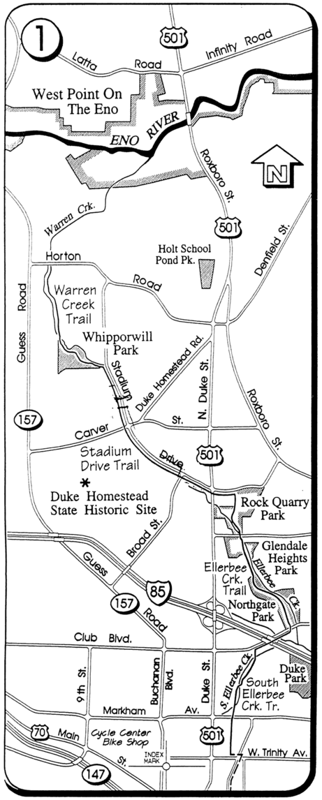
[[Image:2007-ATT-1.png|461px]] | [[Image:2007-ATT-1.png|461px]] | ||
Revision as of 00:56, 16 July 2010
Earth: United States: North Carolina: Durham: South Ellerbee Creek Trail
Connections
- North: Whippoorwill Park and the Eno River Trail (eventually)
- West: West Ellerbee Creek Trail (eventually)
- South: American Tobacco Trail
About
The South Ellerbee Creek Trail is a bike/pedestrian trail which runs north from the downtown section of the American Tobacco Trail north to approximately Whippoorwill Park. A connection to the east-west Eno River Trail is planned but, as far as we know, not yet complete.
It will also be the northern terminus of the West Ellerbee Creek Trail when that has been built.
