File:2007-ATT-4.png
from HTYP, the free directory anyone can edit if they can prove to me that they're not a spambot
Error creating thumbnail: File missing
Other resolution: 370 × 1,280 pixels.
Original file (370 × 1,280 pixels, file size: 85 KB, MIME type: image/png)
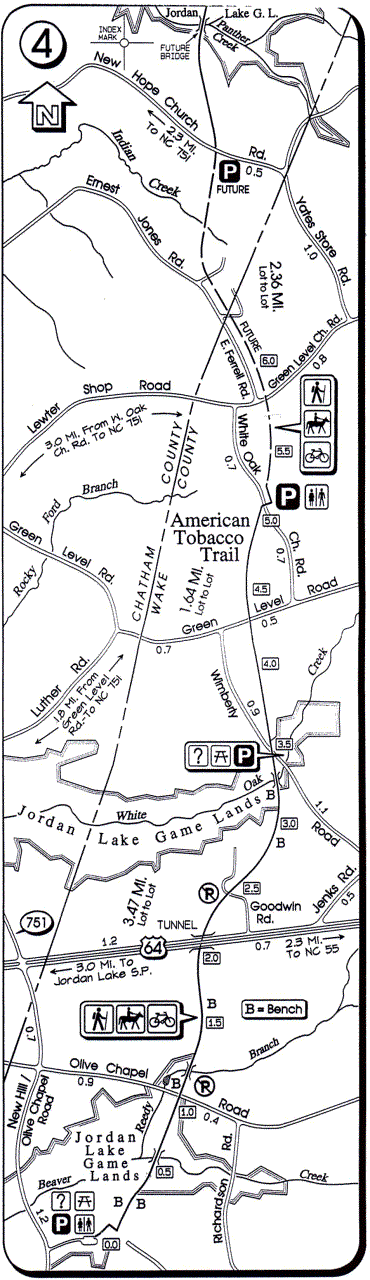
Map of section 4 of the American Tobacco Trail, as of early 2007
File history
Click on a date/time to view the file as it appeared at that time.
| Date/Time | Thumbnail | Dimensions | User | Comment | |
|---|---|---|---|---|---|
| current | 17:02, 6 June 2007 | Error creating thumbnail: File missing | 370 × 1,280 (85 KB) | Woozle (talk | contribs) | Map of section 4 of the American Tobacco Trail, as of early 2007 |
You cannot overwrite this file.
File usage
The following page uses this file:

