Difference between revisions of "US/NC/Durham/neighborhoods/Pinecrest Road/parking"
< US | NC | Durham | neighborhoods | Pinecrest Road
Jump to navigation
Jump to search
m |
(post-move tidying and other belated updates) |
||
| (10 intermediate revisions by 2 users not shown) | |||
| Line 1: | Line 1: | ||
| − | |||
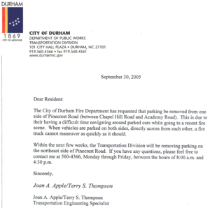
[[Image:2005-09-30 City of Durham re Pinecrest.web.png|thumb|right|letter from the City of Durham]] | [[Image:2005-09-30 City of Durham re Pinecrest.web.png|thumb|right|letter from the City of Durham]] | ||
| + | ==News & Events== | ||
| + | * '''2005-10-27''' meeting | ||
| + | ** [[DFD Traffic Issues Criteria]]: sheet handed out at the meeting | ||
| + | ** Recording of the firestation meeting: <s>[http://www.hypertwins.org/files/htyp/2005-10-27%20pinecrest%20firestation%20meeting.mp3 MP3] 15.4 MB / [http://www.hypertwins.org/files/htyp/2005-10-27%20pinecrest%20firestation%20meeting.ogg OGG] 10.2 MB</s> ''These files are missing at the moment; apparently a complete recursive copy was using some strange new definition of "complete"...--[[User:Woozle|Woozle]] 23:16, 23 June 2010 (UTC)'' | ||
| + | ** '''Brief summary''': It appears that the issue has been resolved for now, with the fire department agreeing that self-policing seems to be working so far and is worth trying as a permanent solution. Cars should be parked as close to the curb as possible, and cars parked on opposite sides of the street should be staggered by at least 44 feet. A fire truck may need as much as 14 feet of width in order to pass comfortably; 12 feet is workable but tight, and significantly slows down response time. Having one side of the street designated a "no parking" area would ''not'', however, hamper the street's qualifications for speed hump installation at a later date; more likely it would increase the average traffic speed, which would if anything increase the street's qualification. There is no such thing as designating a street to be an "emergency access route", as some residents (favoring the ban and opposed to speed humps) have apparently requested (see public records images). The issue of speed humps was also discussed; I have created a page for the latest status on that issue: [[Pinecrest Speed Humps]] | ||
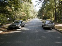
* '''2005-10-01''' The City of Durham says they will soon be forbidding parking on the north side of old Pinecrest, in an effort to allow fire engines to get through faster. (This will also no doubt aid the many morning commuters, who also use Pinecrest as the fastest route between Point A and Point B, to get to their respective fires.) Should we start an online petition about this? Some pictures showing the available space in the road (hover over thumbnails to see caption; click on thumbnail for larger picture): | * '''2005-10-01''' The City of Durham says they will soon be forbidding parking on the north side of old Pinecrest, in an effort to allow fire engines to get through faster. (This will also no doubt aid the many morning commuters, who also use Pinecrest as the fastest route between Point A and Point B, to get to their respective fires.) Should we start an online petition about this? Some pictures showing the available space in the road (hover over thumbnails to see caption; click on thumbnail for larger picture): | ||
[[Image:PA030001 opposing cars on pinecrest.jpg|200px|Two cars, parked opposite each other on the Academy-Dogwood section of Pinecrest Road]] | [[Image:PA030001 opposing cars on pinecrest.jpg|200px|Two cars, parked opposite each other on the Academy-Dogwood section of Pinecrest Road]] | ||
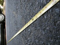
[[Image:PA030002 tape measure crossing street.jpg|200px|Tape measure crossing between the two cars, showing the whole tape measure and a distance of at least 11'4"]] | [[Image:PA030002 tape measure crossing street.jpg|200px|Tape measure crossing between the two cars, showing the whole tape measure and a distance of at least 11'4"]] | ||
[[Image:PA030003 tape measure at car.jpg|200px|Tape measure at right-hand car, showing that the distance is closer to 12 feet]] | [[Image:PA030003 tape measure at car.jpg|200px|Tape measure at right-hand car, showing that the distance is closer to 12 feet]] | ||
| + | |||
==Public Records Request== | ==Public Records Request== | ||
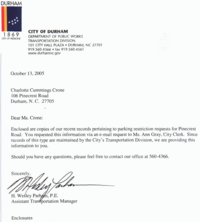
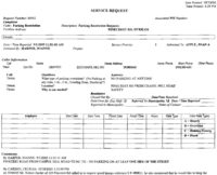
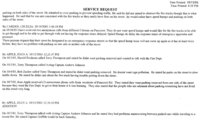
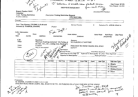
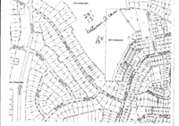
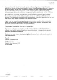
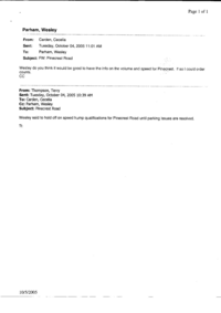
After an NC Public Records request, the following information was received, including a copy of the initial request. I have included all pages, many of which are from the Durham GIS - and somewhat outdated at that. I did not attempt OCR specifically so this public-but-personal information is not easily used for nefarious purposes. The 16 pages linked here comprise the entirety of the public records supplied, though astute observers may note other undocumented references. | After an NC Public Records request, the following information was received, including a copy of the initial request. I have included all pages, many of which are from the Durham GIS - and somewhat outdated at that. I did not attempt OCR specifically so this public-but-personal information is not easily used for nefarious purposes. The 16 pages linked here comprise the entirety of the public records supplied, though astute observers may note other undocumented references. | ||
| − | [[Image: | + | Of particular interest to readers are the dates on these records; take note of which dates were added by computers and which were added by people. |
| + | |||
| + | [[Image:Pubrec_parking_1.png|200px|Cover Letter]][[Image:Pubrec_parking_2.png|200px|Updated computer log]][[Image:Pubrec_parking_3.png|200px|Updated computer log, page 2]][[Image:Pubrec_parking_4.png|200px|Original computer log with handwritten annotations]][[Image:Pubrec_parking_5.png|200px|Street and area map]][[Image:Pubrec_parking_6.png|200px|Letter that was sent to residents]][[Image:Pubrec_parking_7.png|200px|GIS Request 1, page 1]][[Image:Pubrec_parking_8.png|200px|GIS Request 1, page 2]][[Image:Pubrec_parking_9.png|200px|GIS Request 2, page 1]][[Image:Pubrec_parking_10.png|200px|GIS Request 2, page 2]][[Image:Pubrec_parking_11.png|200px|GIS Request 3, page 1]][[Image:Pubrec_parking_12.png|200px|GIS Request 3, page 2]][[Image:Pubrec_parking_13.png|200px|Lengthy e-mail conversation about public records]][[Image:Pubrec_parking_14.png|200px|Lengthy e-mail conversation about public records, page 2]][[Image:Pubrec_parking_15.png|200px|Brief e-mail conversation about speed humps]][[Image:Pubrec_parking_16.png|200px|Work order for "No Trucks" signs]] | ||
==Related Issues== | ==Related Issues== | ||
| − | * | + | * [[../speed humps|speed humps]] |
Latest revision as of 23:16, 23 June 2010
News & Events
- 2005-10-27 meeting
- DFD Traffic Issues Criteria: sheet handed out at the meeting
- Recording of the firestation meeting:
MP3 15.4 MB / OGG 10.2 MBThese files are missing at the moment; apparently a complete recursive copy was using some strange new definition of "complete"...--Woozle 23:16, 23 June 2010 (UTC) - Brief summary: It appears that the issue has been resolved for now, with the fire department agreeing that self-policing seems to be working so far and is worth trying as a permanent solution. Cars should be parked as close to the curb as possible, and cars parked on opposite sides of the street should be staggered by at least 44 feet. A fire truck may need as much as 14 feet of width in order to pass comfortably; 12 feet is workable but tight, and significantly slows down response time. Having one side of the street designated a "no parking" area would not, however, hamper the street's qualifications for speed hump installation at a later date; more likely it would increase the average traffic speed, which would if anything increase the street's qualification. There is no such thing as designating a street to be an "emergency access route", as some residents (favoring the ban and opposed to speed humps) have apparently requested (see public records images). The issue of speed humps was also discussed; I have created a page for the latest status on that issue: Pinecrest Speed Humps
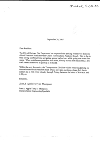
- 2005-10-01 The City of Durham says they will soon be forbidding parking on the north side of old Pinecrest, in an effort to allow fire engines to get through faster. (This will also no doubt aid the many morning commuters, who also use Pinecrest as the fastest route between Point A and Point B, to get to their respective fires.) Should we start an online petition about this? Some pictures showing the available space in the road (hover over thumbnails to see caption; click on thumbnail for larger picture):
Public Records Request
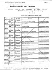
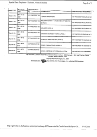
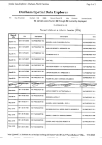
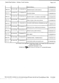
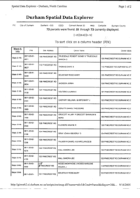
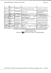
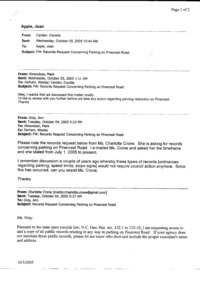
After an NC Public Records request, the following information was received, including a copy of the initial request. I have included all pages, many of which are from the Durham GIS - and somewhat outdated at that. I did not attempt OCR specifically so this public-but-personal information is not easily used for nefarious purposes. The 16 pages linked here comprise the entirety of the public records supplied, though astute observers may note other undocumented references.
Of particular interest to readers are the dates on these records; take note of which dates were added by computers and which were added by people.
